 Da mesociclone Ven 19 Feb - 0:09
ESTOFEX

Storm Forecast
Valid: Fri 19 Feb 2010 06:00 to Sat 20 Feb 2010 06:00 UTC
Issued: Thu 18 Feb 2010 20:52
Forecaster: TUSCHY
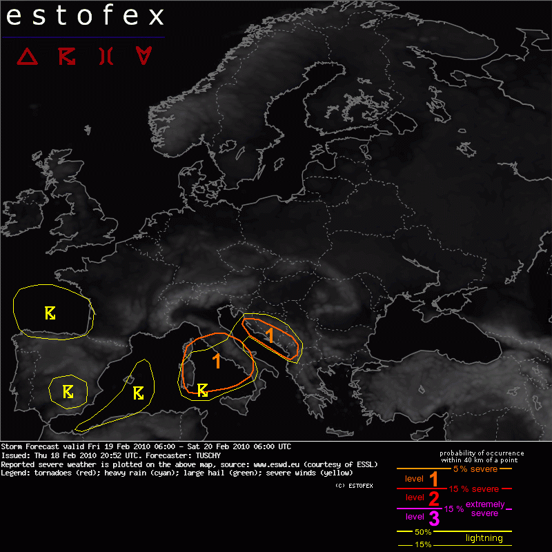
A level 1 was issued for the Tyrrhenian Sea, Sardinia, Corsica and parts of Italy mainly for severe wind gusts and an isolated tornado.
A level 1 was issued for the E-Adriatic Sea mainly for severe wind gusts and an isolated tornado.
SYNOPSIS
A progressive SW-erly flow covers most parts of Europe and attendant disturbances cause unsettled conditions. Another intense upper trough amplifies over W-Europe during the forecast and gradually moves towards the east.
DISCUSSION
.... Central Mediterranean ....
A strong depression moves eastwards over the central Mediterranean. A tight pressure gradient over central Italy weakens betimes, so in respect of shear, the environment would be supportive for organized storms. Instability however is marginal at best and only MUCAPE values are forecast over central Italy during the morning hours/noon and some SBCAPE over the Adriatic Sea thereafter. We can't completely rule out a few storms over the Tyrrhenian Sea/central Italy until noon/early afternoon and given intense LL shear, severe wind gusts are possible. We therefore have to upgrade a broad area to a level 1 despite the low-end thunderstorm probabilities. An isolated tornado will be possible with any longer lived storm but LL CAPE release is not impressive.
After noon, thunderstorm probabilities increase over the eastern Adriatic Sea with severe wind gusts and a local tornado event. We again issued a level 1.
Over W-Europe, a few storms could evolve mainly offshore, but also over S-central Spain during the afternoon/evening hours. We decided to issue numerous thunderstorm areas with low probabilities due to low-end CAPE. Nothing severe is expected.


